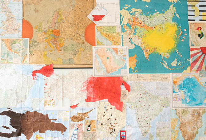
54ºS-78ºN
Continued since 2019
Interventions on maps, various dimensions
Maps don’t only show us the way. They also reveal the traces of interactions between different groups: conflicts, colonisations, transactions. They are graphic representations of political and ideological agendas, of ethnocentric perspectives, of the capitalist appropriation of the common Earth. Maps can reflect conquests—territorial or economic, actual or imagined, historical or ongoing. As political instruments, they reveal our attitude toward the past: memory or unmemory, as well as our present struggles and visions for the future. When we look at a map, we “occupy” the territory it represents by projecting our desires, fears, and sentiments onto it.
My interventions on maps explore the relationships between groups, their attitudes toward specific territories, and the visible transformations of the Earth’s surface caused by human activity. I treat each map as a distinct space for action. Through gestures of appropriation, division, or unification, I aim to expose existing prejudices and collective phantasms.


